There will be periods of light rain on Wednesday, diminishing by Thursday morning. If you have plans on either days, dress in layers and don't cancel, because it will not be a total washout. Expect a GRAPHIX map to be published soon by Expert Meteorologist Dominc.
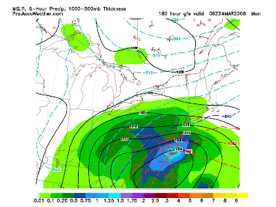
Now for the long range, it gets very exciting. Consistent runs of the GFS and ECMWF weather models show a huge snowstorm barreling up the coast early next week. This will be close to call because of several factors. Although the temperatures should be below freezing, the storm could still track off shore. Relating back to this weekend's storm, the leading system gained strenth and pulled down too much cold and dry air. Basically, this caused the second storm to go way to our south. For now, keep a close eye on this potential spring snowstorm that could lengthen southern New England's ski season!


Sunday, March 16, 2008
Rainy on Wednesday and Thursday, Long Range?
Forecast Prepared By Tyler Jankoski at 8:23 PM
Subscribe to:
Post Comments (Atom)

0 comments:
Post a Comment