WATCH IN HIGH QUALITY!
Wednesday, January 28, 2009
Severe Sledding Accident on Chippens Hill
WATCH IN HIGH QUALITY!
Forecast Prepared By Tyler Jankoski at 1:38 PM 0 comments
Tuesday, January 27, 2009
Major Snow & Ice Storm Tomorrow
A moderate snow will fall on the Bristol area, crippling the Wednesday morning commute. The snow may fall heavily at times during the morning hours as the storm begins to ramp up. Expect a total snow accumulation of 4"-6". The snow will then change to sleet and freezing rain by noontime. We could see around one quarter of an inch of ice accretion. Coupled with the snow already on the trees and power lines, this ice may break some limbs and cause scattered power outages. The temperature should hover between 30 and 35 degrees through the early afternoon. A change to plain rain is possible around dinner time.
80% - 100% No School
(Final Update by 6PM)
Final Snow Accumulation Map:

Forecast Prepared By Tyler Jankoski at 3:19 PM 0 comments
Monday, January 26, 2009
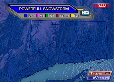
Powerfull Snowstorm to Pound Region
Forecast Prepared By Tyler Jankoski at 5:49 PM 0 comments
Sunday, January 25, 2009
Major Snowstorm Possible Wednesday

Forecast Prepared By Tyler Jankoski at 12:48 PM 0 comments
Monday, January 19, 2009
Inauguration Weather
Many will be shifting focus to Washington DC tomorrow with the Inauguration. Skies should be mostly cloudy through the day, with light winds. The high temperature will likely be right around freezing, with a noontime temperature near 30.
To the left is the experimental hourly forecast chart generated by the NWS.
Below is a summary of the weather for past Inaugurations back to 1937, courtesy of the Washington Post. Only four years featured below freezing temperatures at noon. 2009 may join that club.
Forecast Prepared By Sam Lillo at 4:47 PM 0 comments
Sunday, January 18, 2009
Saturday, January 17, 2009
Clipper Brings Decent Snow to Region
Forecast Prepared By Tyler Jankoski at 12:47 PM 0 comments
Thursday, January 15, 2009
Snowstorm Possible Sunday into Monday

Forecast Prepared By Tyler Jankoski at 5:22 PM 0 comments
Wednesday, January 14, 2009
Final Snow & School Predictions
40% Regular Day
(This is more of a perfect timing event, and not a heavy accumulation event. The snow will start around daybreak, and continue until noon time. This does not qualify under a delay, because buses would be running in the heart of the storm. Even though only 2"-4" of snow is expected, the timing is inevitably proper for a school cancellation.)
Final Snowfall Map:

Forecast Prepared By Tyler Jankoski at 8:40 PM 0 comments
Tuesday, January 13, 2009
Minor Snow Event Thursday
Forecast Prepared By Tyler Jankoski at 6:10 PM 0 comments
Monday, January 12, 2009
Minor Snowfall Thursday
Forecast Prepared By Tyler Jankoski at 6:52 PM 0 comments
Saturday, January 10, 2009
Tyler's Weather Bulletins
Forecast Prepared By TruWX Chief and Tyler's Weather Alert Issuer Jimmy at 9:34 PM 0 comments
Winter Storm Warnings & Final Forecast
Forecast Prepared By Tyler Jankoski at 10:13 AM 0 comments
Friday, January 9, 2009
Big Snowstorm This Weekend
Forecast Prepared By Tyler Jankoski at 3:20 PM 0 comments
Monday, January 5, 2009
Updated Storm Details
Forecast Prepared By Tyler Jankoski at 7:03 PM 0 comments
Winter Storm Watch Issued
NATIONAL WEATHER SERVICE TAUNTON MA
333 PM EST MON JAN 5 2009
ACROSS PORTIONS OF SOUTHERN NEW ENGLAND LATE TUESDAY NIGHT AND
WEDNESDAY...
...WINTER STORM WATCH IN EFFECT FROM TUESDAY EVENING THROUGH
WEDNESDAY EVENING...
THE NATIONAL WEATHER SERVICE IN TAUNTON HAS ISSUED A WINTER STORM
WATCH...WHICH IS IN EFFECT FROM TUESDAY EVENING THROUGH WEDNESDAY
EVENING.
THIS WATCH INCLUDES SOUTHWEST AND SOUTH CENTRAL MASSACHUSETTS...NORTHERN
CONNECTICUT AND NORTHWEST RHODE ISLAND.
SNOW IS EXPECTED TO DEVELOP ACROSS THE REGION LATE TUESDAY NIGHT. THE SNOW MAY BECOME BRIEFLY HEAVY NEAR DAYBREAK WEDNESDAY MORNING...WITH A BETTER CHANCE NEAR THE MASSACHUSETTS TURNPIKE. HOWEVER...WARM AIR IS EXPECTED TO MOVE IN ALOFT CHANGING THE PRECIPITATION OVER TO SLEET AND FREEZING RAIN ACROSS MOST LOCATIONS BY MID TO LATE MORNING.
FREEZING RAIN MAY BECOME THE PREDOMINANT PRECIPITATION TYPE AND CONTINUE THROUGH THE AFTERNOON. THIS IS PARTICULARLY TRUE TO THE NORTHWEST OF I-84 AND INTO THE HIGH TERRAIN...WHERE TEMPERATURES MAY REMAIN BELOW FREEZING FOR THE ENTIRE EVENT. THE POTENTIAL EXISTS FOR BETWEEN ONE QUARTER AND ONE HALF INCH OF ICE ACCRETION ACROSS A PORTION OF THIS REGION.
IT STILL REMAINS UNCERTAIN WHAT THE PREDOMINANT PRECIPITATION TYPE
WILL BE FROM THIS STORM. IF THE LOW PRESSURE SYSTEM TRACKS CLOSER TO THE
COAST...MORE OF AN ICE EVENT CAN BE EXPECTED WITH JUST SOME SNOW AT THE
ONSET. IF THE LOW TRACKS FURTHER SOUTH...WE WILL BE DEALING WITH
SEVERAL INCHES OF SNOW WITH NOT AS MUCH ICE. REGARDLESS...THE WEDNESDAY
MORNING RUSH HOUR MAY BE QUITE MESSY SO PLAN ACCORDINGLY.
Forecast Prepared By Tyler Jankoski at 7:00 PM 0 comments
Sunday, January 4, 2009
Mid-Week Wintry Mess
Forecast Prepared By Tyler Jankoski at 1:59 PM 0 comments


